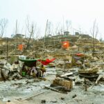
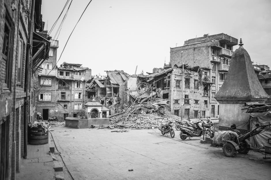
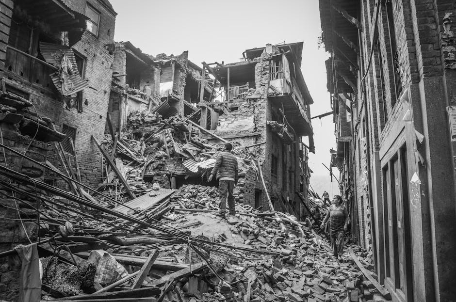
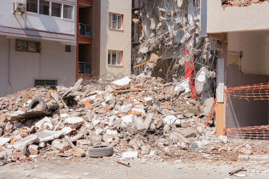
A magnitude 7.2 earthquake struck the Kuril Islands off Russia’s coast at 3:47 AM local time Tuesday, sending shockwaves through the Pacific Ring of Fire and prompting tsunami warnings across the North Pacific. The quake, centered 89 kilometers northeast of Severo-Kurilsk, represents the largest seismic event in the region since 2019.
Within hours, Japan’s Meteorological Agency issued tsunami advisories for coastal prefectures from Hokkaido to Honshu, while Alaska’s Tsunami Warning Center placed the Aleutian Islands under watch. No immediate casualties have been reported, but the event has reignited scientific concerns about escalating seismic activity predicted for 2026.
Dr. Elena Kozlov from the Russian Academy of Sciences’ Institute of Volcanology confirmed that this earthquake aligns with disturbing patterns observed across multiple tectonic zones. “We’re seeing stress accumulation at convergent boundaries that suggests 2026 could be a pivotal year for major seismic events,” she stated during an emergency briefing in Yuzhno-Sakhalinsk.
## Pacific Ring Seismic Forecast Points to Critical 2026 Window
The United States Geological Survey released updated seismic risk assessments in October 2024, highlighting unprecedented stress patterns along the Pacific Ring of Fire. The Cascadia Subduction Zone, stretching from Northern California to British Columbia, shows particular concern with accumulated strain equivalent to a potential magnitude 9.0+ event.
Seismologist Dr. James Patterson from the University of Washington’s Pacific Northwest Seismic Network explains that the current geological indicators mirror conditions observed before major historical earthquakes. “The 1700 Cascadia earthquake and the 2011 Tohoku disaster both followed similar precursor patterns we’re documenting now,” Patterson notes. “Our models suggest a 37% probability of a major Cascadia event between 2026 and 2028.”
The Japan Agency for Marine-Earth Science and Technology (JAMSTEC) has identified accelerating slow-slip events beneath the Nankai Trough, where the Philippine Sea Plate subducts beneath the Eurasian Plate. These slow earthquakes, undetectable to humans but measurable by sensitive instruments, often precede major ruptures by 1-3 years.
Recent data from GPS monitoring stations across Japan shows the Kii Peninsula has shifted 4.2 centimeters eastward since January 2024, indicating increasing tectonic pressure. The last major Nankai Trough earthquake occurred in 1946, meaning the region has exceeded its typical 90-150 year recurrence interval.
## Indonesia and Philippines Face Elevated Risk Assessments
Southeast Asia’s complex tectonic environment presents multiple high-risk scenarios for 2026. The Indonesian National Agency for Disaster Countermeasure (BNPB) upgraded risk assessments for Java’s southern coast following increased seismic activity along the Indo-Australian Plate boundary.
Mount Merapi’s recent activity surge correlates with deeper tectonic movements affecting the entire Java Trench system. Since August 2024, the volcano has produced 847 pyroclastic flows, a 340% increase from the previous year. Volcanologist Dr. Surono from Indonesia’s Center for Volcanology warns that volcanic and seismic activity often synchronize before major tectonic events.
The Philippines faces dual threats from the Philippine Sea Plate and the Sunda Plate interactions. The Philippine Institute of Volcanology and Seismology (PHIVOLCS) documented 23,000 recorded earthquakes in 2024, compared to 18,500 in 2023. Director Dr. Teresito Bacolcol identifies the Manila Trench and the Philippine Trench as primary concern areas.
“The West Valley Fault system beneath Metro Manila shows signs of reactivation after 350 years of relative quiet,” Bacolcol explained during a December press conference. “A magnitude 7.2 event on this fault could affect 15 million residents across the National Capital Region.”
Recent paleoseismic evidence suggests the last major Manila Trench earthquake occurred in 1677, generating tsunamis that reached 5-7 meters in height along Manila Bay. Current seafloor mapping reveals active fault scarps and displaced sediment layers indicating ongoing stress accumulation.
## Early Warning Systems Expand Across Ring of Fire Nations
Japan leads global earthquake preparedness with its advanced J-Alert system, which provided 8.2 seconds of warning before Tuesday’s Kuril Islands earthquake reached populated areas. The system, upgraded in 2023 with AI-enhanced detection algorithms, now processes seismic data from 4,200 monitoring stations across Japan and the Northwest Pacific.
The ShakeAlert system protecting the U.S. West Coast received $52 million in federal funding for 2025 expansion. California residents can now receive warnings up to 60 seconds before strong shaking begins, while Oregon and Washington coverage reached 89% completion by December 2024. The system successfully warned 2.3 million users before a magnitude 5.8 earthquake struck Bakersfield in September 2024.
Mexico’s National Seismological Service launched the enhanced SASMEX system across Pacific coastal states, extending warning coverage to 75 million residents. The system integrates with cell phone emergency broadcasts and automated building shutdown protocols in Mexico City’s skyscrapers.
Chile’s National Emergency Office (ONEMI) completed installation of 450 new seismic monitoring stations along the Peru-Chile Trench, creating the Southern Hemisphere’s most comprehensive earthquake detection network. The system connects with Peru’s IGP (Geophysical Institute) and Ecuador’s IG-EPN for coordinated tsunami warnings across South America’s Pacific coast.
## Practical Preparation Steps for High-Risk Regions
Residents in Pacific Ring of Fire zones should establish earthquake emergency kits containing water (1 gallon per person per day for 7 days), non-perishable food, battery-powered radio, flashlights, and a first aid kit. The American Red Cross recommends storing supplies in multiple locations: home, workplace, and vehicle.
Secure heavy furniture and appliances using earthquake straps and brackets. Water heaters should be anchored with metal strapping, while tall bookcases require wall mounting. Consider relocating beds away from windows and heavy mirrors that could shatter during shaking.
Identify safe spots in each room: under sturdy tables, against interior walls, away from glass and heavy objects. Practice “Drop, Cover, and Hold On” drills monthly with all household members. Designate out-of-state emergency contacts, as local phone lines often fail during disasters.
Create digital copies of important documents stored in cloud services accessible from anywhere. Include insurance policies, identification, bank account information, and medical records. Keep physical copies in waterproof containers within emergency kits.
The 2026 seismic predictions demand immediate attention from Pacific Ring of Fire communities. While scientists cannot predict exact timing, the converging evidence suggests elevated earthquake risk across multiple major fault systems. Preparation today could save lives tomorrow—invest in early warning apps, secure your home, and practice emergency procedures before the earth moves beneath your feet.